


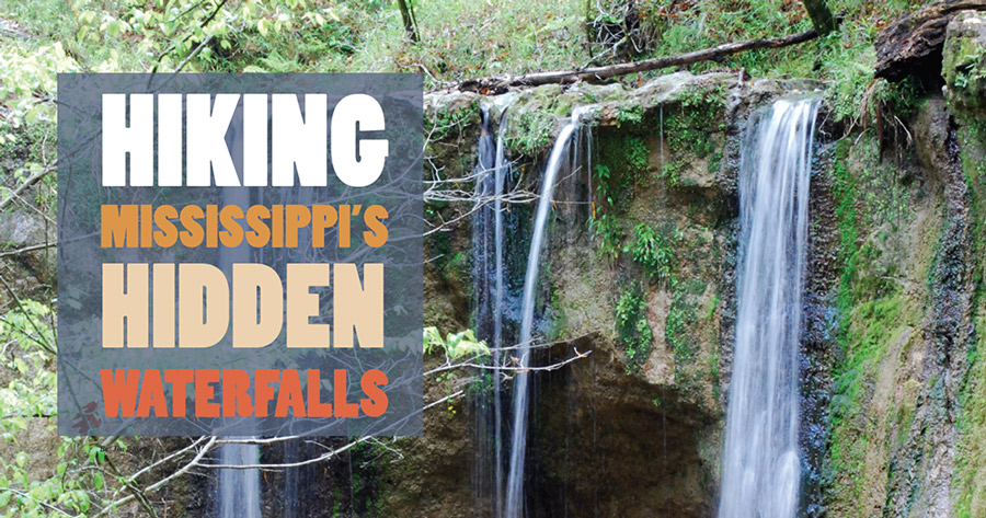
Hiking Mississippi's Hidden Waterfalls
12/5/2017 11:16:09 AM
By Jim Beaugez
Hikers dream of negotiating steep, narrow ridgelines and dis-covering coves carved by waterfalls on spring-fed creeks. Places where boulders litter the creek bottoms and clear streams meander through deep ravines under the shade of hardwoods.
To many southern adventurers, that describes a trip to the Appalachians or Ozarks more than a hike in Mississippi. But for the 30,000 annual visitors to Clark Creek Natural Area, it’s the place where they can find it all in one spot, right here in Mississippi. And Clark Creek is one of several Mississippi State Parks taking part in First Day Hikes, a nationwide initiative to encourage people to get outdoors on New Year’s Day.
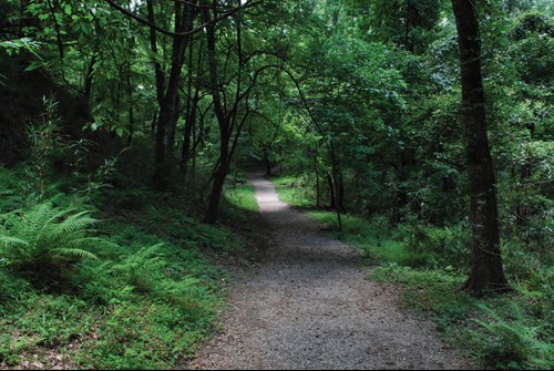
Just a few miles east of the wide, Mississippi River channel, hikers can experience the state’s most challenging terrain and discover nearly 50 waterfalls dropping from ledges as high as 30 feet.
Located 40 miles south of Natchez in Wilkinson County, Clark Creek Natural Area covers 700 acres of rolling hills, where an abundance of beech, magnolia, and pine trees tower overhead. Rarer species such as the Southern sugar maple, serviceberry, umbrella tree, pyramid magnolia, chinquapin oak, big leaf snowbell, silverbell, and witch hazel also thrive here.
The protected tract hosts a variety of migrating and resident birds, a rare land snail, the federally endangered Carolina magnolia vine, and a state-endangered fish, the Southern red belly dace. Mammals, small and large, ranging from chipmunks and squirrels to deer and even bears, are known residents and visitors.
“It’s like stepping back in time to the way things were hundreds of years ago in the wilderness,” said hiker Jason Douglas of Pearl. “It’s not just pine trees. It’s a very diverse forest.”
Douglas founded the Mississippi Hiking Club to meet like-minded adventurers and arrange hikes to explore the state’s trails as a group. He discovered Clark Creek Natural Area while on a temporary assignment inspecting parks for the Mississippi Department of Wildlife, Fisheries, and Parks (MDWFP) after college in 2004, and has led several group hikes through the area since then.
“I was amazed, because I didn’t know that we had a place like this in the state,” he said. “I just fell in love with it.”
What gives Clark Creek its greatest charms—the dozens of waterfalls splashing into hidden coves—have to do with what is under the soil, according to James B. Harris, professor of geology at Millsaps College. Harris said the area gives visitors a look inside Mississippi’s natural history as the trails wind through three significant geological zones.
At the entrance to Clark Creek Natural Area on top of the bluffs is an area of tan, wind-blown silt called loess dating to about 20,000 years ago. The fine sediments washed down from the Midwest as glaciers retreated, and strong, westerly winds blew it over to the eastern side of the Mississippi Valley.
“The bluffs go from that area, basically Natchez and south, all the way up into western Kentucky,” said Harris. “It’s an interesting deposit—it’s unique. The glaciers were a long way from us, but we still have wind-blown glacial de-posits in our state.”
Below the loess lies a sandy unit of pre-loess gravel, distinguished by orange-red deposits common to river systems and deltas, which dates to the Pleistocene epoch between 100,000 and 2 million years ago. The most interesting layer for most visitors, however, peeks out from underneath the sand and gravel to form the area’s signature waterfalls, out-croppings, and boulder fields.
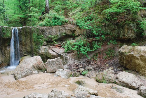
Known to geologists as the Pascagoula formation and dating to the Miocene epoch around 5 to 10 million years ago, this hardened section of clays and sediments is resistant to weathering. The creeks and streams take the path of least resistance, washing away layers of loess and pre-loess, leaving hardened ledges behind and washing boulders downstream. The spring-fed streams drop off the ledges, giving adventurers the thrill and scenery of a mountain hiking experience hundreds of miles from the nearest ranges.
“As the tributaries to Clark Creek cut down through those less resistant units above, they get stalled out on those ledgy Pascagoula clays and silts, and that’s what forms the waterfalls,” said Harris.
All three layers are visible, and it doesn’t take a trained geologist to notice them. Hikers walk through and over the darker hues and softer textures of the loess beginning at the trailhead. The ridgeline soon descends sharply into the pre-loess area as the improved trail follows the crunchy, orange-red gravel about 100 feet down in elevation. Sharp eyes can spot thin, purplish markers of suspected volcanic ash no more than an inch thick.
While walking Clark Creek Natural Area’s nearly two miles of wide, improved trails, hikers can take multiple forks leading to waterfalls and the area’s namesake main waterway. Another 2.6 miles of primitive trail loops around the southern boundary, crossing creeks and tributaries, passing more waterfalls and scaling steep hills.
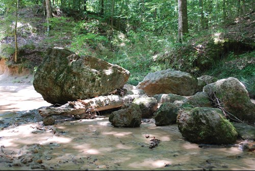
At the western end of the improved trail, wooden stairs lead to a creek bottom where splotches of orange iron oxide emerge from the blue-gray Pascagoula clays. To the left, hikers can pick up the primitive trail, while a right turn along the creek bed leads to massive boulders washed out and deposited in heavy rains over many years. The trail splits toward two separate waterfalls, each trail strewn with more rock de-posits.
“You can kind of boulder-hop across these rocks to get to the waterfalls,” said Douglas.
Although spring and fall are the most popular times to visit Clark Creek, the trailhead can fill up with cars quickly, even during the peak summer months.
“On a beautiful Saturday, you’ll have to park on the street sometimes if you get there later in the day,” said Douglas. “We’ll leave at 6 a.m. and stop at the Pond Store and get on the trail before it gets crowded. Saturdays are really busy, but if you go on a weekday you almost have it to yourself.”
The trailhead at this remote outpost, officially established as a state area in 1978, features restrooms, maps, and an honor box, where visitors can pay the $4-per-vehicle entry fee. The improved trail includes several staircases along especially steep portions of the trail, and an observation deck for the popular triple waterfall, where water streams down from three separate rivulets. A handful of lean-to shelters are available for resting along the trails.
“You don’t have to drive hours away to the mountains to see this kind of terrain and waterfalls,” said Douglas. “There’s not another place like it in the state.”
Jim Beaugez is a freelance writer for Mississippi Outdoors

