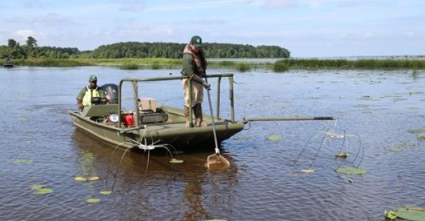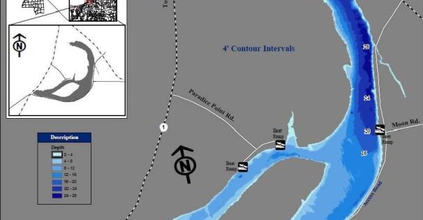
*Moon Lake is an oxbow lake managed by the Mississippi Department of Wildlife, Fisheries, and Parks (MDWFP), which oversees the lake's fisheries resources and provides regular fishing reports.

Moon Lake is a 2,300-acre oxbow lake of the Mississippi River. The primary inflow to the lake comes from Phillips Bayou at the northern tip of the lake.  The main outflow is Yazoo Pass which connects the lake to the Coldwater River.

Fishing Report - 3/19/2025 

SpeciesDetail
BassWater temperatures are still on the cooler side, which means fish are less active. However, with warmer weather on the way, look for the activity start to pick up. Suspended crank baits, spinner baits, and worms are a good choice. Target deeper areas with structure and cover as well as transition zones between deep and shallow areas as temps rise.
CrappieExpect crappie feeding activity to increase with warmer water temperatures. Look for any structure in the lake and try various depths. Trolling along the edges and drop-offs along the cypress trees may be a good option. Using jigs or minnows is a good choice.
BreamBream fishing during the winter months can be slow but look for action to start to pick up soon. Fish should begin to move shallow with the increasing water temperatures. Look for cover and structure throughout the lake. Both crickets and redworms could be good choices for bait.
CatfishWinter catfish are slow to bite. However, with warmer weather on the way, look for the catfish activity to increase. Try fishing near the bottom with liver, nightcrawlers, or cut bait.
Moon Lake Special Regulations

Creel and Size Limits

SpeciesLengths to ReleaseDaily Creel Limits
Black Bass (combined largemouth, spotted and smallmouth)No Length Limit5 per angler
Crappie (combined black and white)10 inches and under30 per angler
  • Creel and size limits apply to anglers fishing east of Highway 1

Statewide creel and size limits apply to all other fish species

Mississippi River Stages

*Moon Lake Interactive Map

Find and learn more about *Moon Lake...

Zoom in
Zoom out
  • State Lakes
  • Lake Point Features
  • Boat Ramps
  • Bait Shops
  • Lake Line Features
    GOLF FAIRWAY
    ATV TRAIL
    DISC GOLF COURSE
    HORSE TRAIL
    MOTOCYCLE TRAIL
    NATURE TRAIL
    OTHER
Esri, NASA, NGA, USGS, FEMA | Esri Community Maps Contributors, Arkansas GIS Office, Esri, TomTom, Garmin, SafeGraph, GeoTechnologies, Inc, METI/NASA, USGS, EPA, NPS, US Census Bureau, USDA, USFWS
Powered by Esri