
If you have questions about purchasing a license call 1-800-5GO-HUNT.
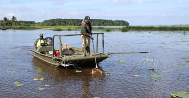
 *Sardis Reservoir is operated by the U.S. Army Corps of Engineers (COE). The MDWFP Fisheries Bureau manages the lake's fisheries resources and provides weekly fishing reports.
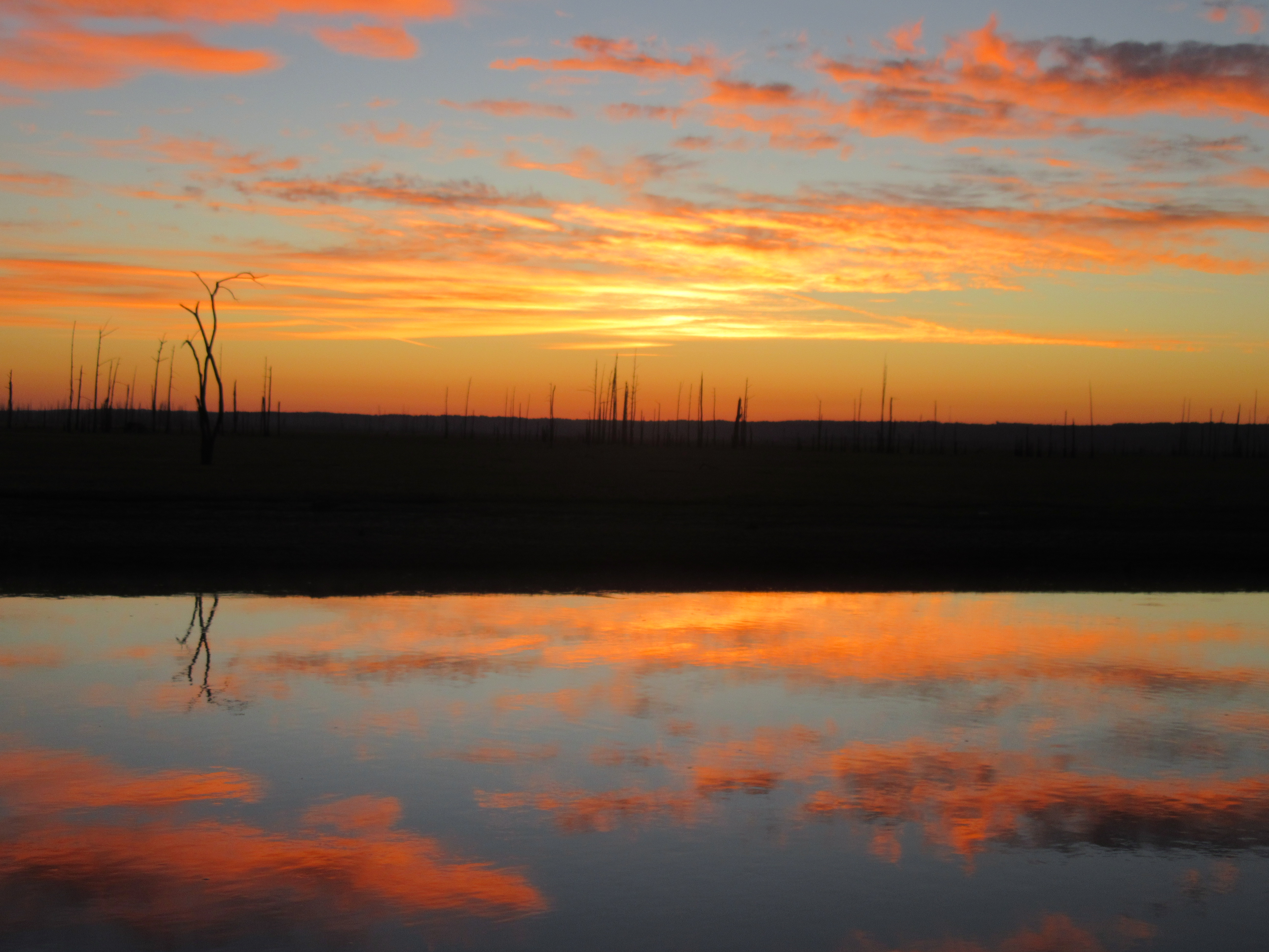
Sardis Reservoir is one of four flood control reservoirs (FCRs) in north Mississippi. Built by the US Army Corps of Engineers (COE) in 1939 on the Little Tallahatchie River, it is the oldest FCR with a summer pool of 32,100 ac. Water levels follow an annual rule curve, but deviate from it due to local precipitation and COE spillway gate operations. The reservoir is lowered in fall to winter pool (10,700 ac); flood pool is 58,500 ac. Sardis is the state’s most popular angling destination. Unique to Sardis is the 400-acre Lower Lake below the spillway.
For more information on this lake's fees, permits, rules and regulations, and amenities visit the Sardis Lake page at the U.S. Army Corps of Engineers website.
New crappie regulations went into effect on July 24, 2024 on the four Flood Control Reservoirs (Arkabutla, Sardis, Enid, and Grenada) and their spillways.
The daily creel limit for crappie is 10 fish per angler, and the daily aggregate limit is 25 fish for boats with three or more anglers. Crappie must be over 12 inches, and the pole limit remains at 4 per angler. In addition, fish may only be cleaned at designated fish cleaning stations if available, not on the water or in the boat ramp parking lots. In the spillways, the daily limit is 10 fish per angler. There are no boat or size limits in the spillways. Pole limits in the rip-rapped portions of the spillways remain 1 per angler.
| Species | Detail |
|---|---|
| Largemouth Bass | Bass are moving shallower via tributaries and ditches. Some may be spawning now; look for firm bottom (flooded gravel roads, 4-wheeler trails, etc.). Any cover (brush or stake beds, wood, flooded vegetation, etc.) is a plus. Fish from the surface to 6 ft deep with search baits (buzzbaits, spinnerbaits, vibrating jigs). Soft plastics (Carolina or Texas-rigged worm, swimbait, etc.) fished slowly should work for finicky fish. |
| Crappie | Bruce at Wyatt's Crossing Outdoors 901-870-0298 and MDWFP creel surveys have seen fish being caught up shallow by boat, bank, or wading anglers with the water stabilizing and clearing. Crappie spawning is in full swing. Most anglers have been fishing in the upper end of the lake (east of Toby Tubby Creek and Holiday Lodge). Fish jigs and/or minnows 1 - 5 ft deep in the backs of creeks, out from spawning areas (males shallower than females), in spawning areas, trolling in the main lake, or fish from the banks of the river and larger creeks. Use bigger baits and/or fish deeper to target larger crappie. Replace treble hooks with single hooks and/or pinch down the barbs to make releasing short fish faster and less damaging; it does no good to release dead fish. |
| Bream | Fish redworms or other baits 1.5 - 4 ft deep near any cover (timber, brush tops, stake beds, rip-rap, etc.). Any flooded grass would be good. |
| Catfish | Catfishing has been good in the higher water with fish feeding up pre-spawn. Fish worms or stinkbaits in the river and creeks (from boat or bank) if there is rainfall runoff or various natural baits over recently flooded main lake flats. Rod-and-reel (drifting or stationary), trotlines, and noodles (jugs) will all work, but check and/or move lines often if the water starts rising. |
| White Bass | White Bass are being caught near the Hwy 7 bridge. You can launch there now. The fish will be doing the same thing in larger creeks. Fish over sand bars in tributaries with shad-imitating lures (jigs, small crankbaits, etc.). There are no size or number limits on white bass. These fish die quickly in a livewell. They will keep and taste better if put immediately into "slush" (ice/water mix). |
More seasonal temperatures are in store this week with rain moving in this weekend. Water levels should remain fairly stable since the COE cannot release much water with the Mississippi River flooding. Check water level trends; except for catfish, fishing is usually better on a slow fall than a fast rise.
Crappie spawning starts when average daily water temperature at “fish depth” is about 58, peaks at about 65, and ends at about 75 F. Timing and duration of the spawn depends on temperature and water level trends, weather fronts, and moon phases. Fish will spawn shallower in rising water, deeper in falling water. Bigger females usually spawn first. Males of any size can be caught throughout the spawn. Males will stay on the nest until eggs hatch and fry swim up (4 - 7 days) even if the water rises or falls (unless the nest gets too shallow). Males of both Black and White Crappie get darker during the spawn; females do not change color. Historically, crappie spawn on the flood control reservoirs from the last week of March until about the first week of May, but it may shift earlier, later, or be split into two or more peaks due to weather and water fluctuations.
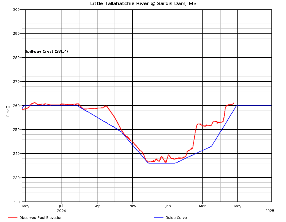
Water level 260.30 ft, rising 0.1 ft/day, 5.4 ft over rule curve Tuesday. Expect water level rises and drawdowns as rain events happen and the Corps tries to achieve and maintain rule curve. The water level is supposed to rise from 241 ft on March 1 to summer pool (260 ft) by May 1. For water level information, call (662)563-4531 or check at Vicksburg District Daily River Bulletin for a table OR Little Tallahatchie River @ Sardis Dam, MS for a graph OR Yazoo River Basin Reservoirs for both (click on 24-hour change for picture explanation of gate flow, spillway flow, etc.). Be sure to check the date on the table; it is usually updated midday.
The spillway had all gates closed (0 cfs) Tuesday. Fishing should improve when they begin to reopen. Best luck in the spillway and Lower Lake is when some water is being released, but not too much. Best luck lately has been for crappie and catfish. For crappie, fish jigs and/or minnows out of the current or right along the rocks. They can also be caught trolling or drifting in the Lower Lake (even with the water cut off). Catfishing is best in eddies on natural bait fished near the bottom in the spillway or near the Lower Lake runout. White Bass will be in the current where you can drift a 2-jig rig just off bottom (watch the rocks!) or fish small crankbaits or tailspinner lures. For bass, cover in the old river run is the best bet, or fish along the rocks in the spillway with spinnerbaits or swimbaits. Expect frequent spillway gate closures and openings as the Corps maintains rule curve in the reservoir above.
Spillway gate openings, flow rates, and spillway water levels can be obtained at (662)563-4531 or check at Vicksburg District Daily River Bulletin for a table OR Little Tallahatchie River @ Sardis Dam, MS for a graph OR Yazoo River Basin Reservoirs for both (click on the "24-hour change" numbers for a picture explanation of gate flow, spillway flow, etc.). Be sure to check the date on the table; it usually is updated midday.
Fish captured and kept with dip or landing nets, cast nets, boat mounted scoops, wire baskets, minnow seines, and minnow traps in the spillway areas bordered by rip rap must be immediately placed on ice or in a dry container. Game fish caught with these gears must be released. This regulation was enacted to reduce the potential of transferring harmful Asian carps to the reservoir or other waters.
The 12-inch crappie length limit does not apply to the reservoir spillway, but the spillway, including Sardis Lower Lake, has a 10-crappie creel limit.
| Species | Lengths to Release | Daily Creel Limits |
|---|---|---|
| Crappie (combined black and white) | 12 inches and under | 10 per angler 25 per boat for boats with 3 or more anglers |
Statewide creel and size limits apply to all other fish species
Find and learn more about *Sardis Reservoir...